Wednesday, September 26, 2007
Sunday, September 23, 2007
Saturday, September 22, 2007
Health First Dental Launched
My brother-in-law, Sean Freiberg, recently launched a website for Health First Dental, his dental practice in Calgary (map). His website can be found at www.healthfirstdental.com . Dr. Freiberg practices biological dentistry, which is a total health approach to dentistry that among other things doesn't use mercury or fluoride in any part of the treatment.
Dr. Freiberg also does cosmetic dentistry and dental implants and sedation dentistry. See some of his before and after photos here. If you're looking for a dentist, I highly recommend Dr. Freiberg. You can even request an appointment online.Wednesday, September 05, 2007
Overheard
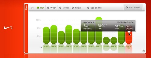
This morning I managed to sqeeze in a 6k run before taking Gracie to school. I was dripping with sweat in the car and the following conversation took place:
Funny.
Grace: "Dad, you're going to make people embarassed by being so
sweaty"
Scott: "Yes, I suppose you're right"
Matt: "When mom walks or runs she doesn't get sweaty"
Grace: "That's because ladies don't sweat"
Funny.
Tuesday, September 04, 2007
Opal Ridge
Sean and I hiked Opal Ridge on Labor Day (see my Flikr photoset here). It was very steep, easily the steepest hike we've ever done (which is more difficult to manage on the decent than on the ascent), but it was also one of the best we've ever done.
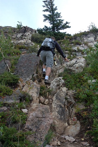
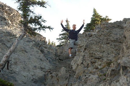
The steepness of the trail made it very difficult to stay on any sort of a path. At various sections of the hike, I'm guessing most hikers just find whatever way they are most comfortable with. I nicknamed one of the crevices "the crucible", because it took me about 5 minutes to navigate a 20 foot section. Here's a picture of Sean coming through the crucible.
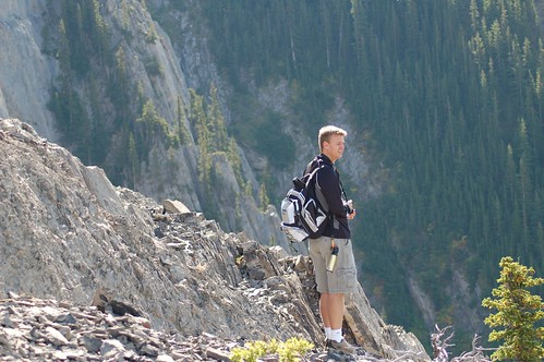
Looking off to the right (South), there is a treed gorge, looking to your left (North), an open valley. This is a photo of Sean looking South toward the gorge.
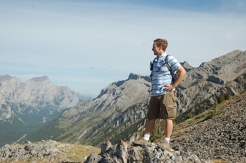
The photo below shows the view looking North.
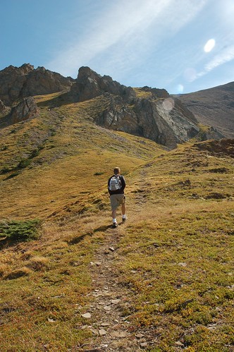
Nearing the top, there is a section of about 700 meters where there is a bit of a clearing that flattens out just a bit.
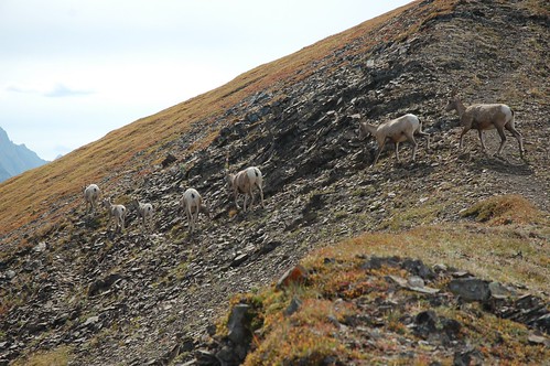
As we got closer to the Ridge we saw some sheep, they didn't seem to bothered by us, but they kept their distance and eventually crossed over the ridge, and went down the other side.
We walked along the top of the ridge for about 1 kilometer to reach the peak of Opal Mountain. To the West of the ridge you can see what used to be Fortress ski resort, to the East, a very large open valley with another mountain range several kilometers away.
The mountains on the East side of the ridge are rocky and grey with no tree cover. The valley seems totally wild and secluded. As we walked along the ridge looking East toward this secluded valley, Sean wondered if we would see any other wildlife..., and sure enough within 10 minutes of reaching the top and hiking the ridge he spotted something about 2 kilometers away, black and moving away from us.
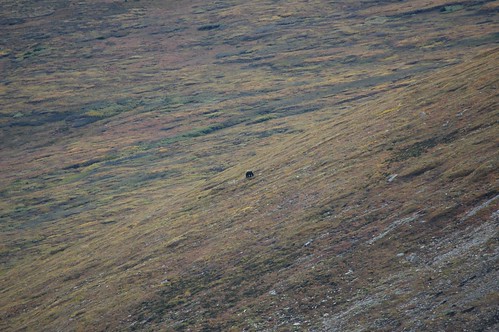
Belive it or not, that little black speck in the center of the photo is a bear. We werent' really sure whether it was a black bear or grizzly, but niether of us took comfort that the name of the alternate route back down the mountain is named "Grizzly Trail."
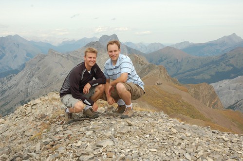
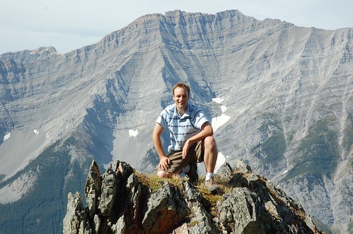
We reached the top and signed our names in the book. The view from the top is incredible. I'm pretty nervous of heights, but I summoned all my intestinal fortitude to rest my camera on the Inukshuk that was formed on the peak, and set the timer to take this photo of sean and I together at the top.
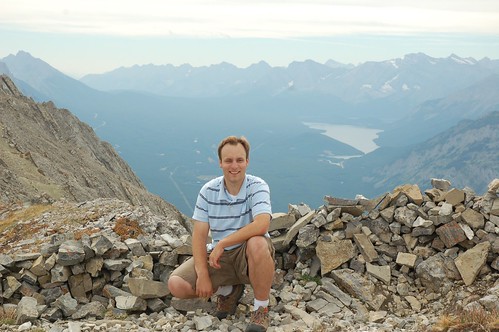
Here's another one of me taken facing South toward Kananaskis Lake.
After some lunch we made our way back down the mountain. I put the camera away for this part of the hike, because it was very difficult to maneuver down the steepness of the mountain. With this kind of steepnes, it's far easier going up than down.
My GPS showed that the hike was 3 kilometers to the ridge and 3.8 to the peak. The round trip took just under 6 hours.

The steepness of the trail made it very difficult to stay on any sort of a path. At various sections of the hike, I'm guessing most hikers just find whatever way they are most comfortable with. I nicknamed one of the crevices "the crucible", because it took me about 5 minutes to navigate a 20 foot section. Here's a picture of Sean coming through the crucible.

Looking off to the right (South), there is a treed gorge, looking to your left (North), an open valley. This is a photo of Sean looking South toward the gorge.

The photo below shows the view looking North.

Nearing the top, there is a section of about 700 meters where there is a bit of a clearing that flattens out just a bit.

As we got closer to the Ridge we saw some sheep, they didn't seem to bothered by us, but they kept their distance and eventually crossed over the ridge, and went down the other side.

We walked along the top of the ridge for about 1 kilometer to reach the peak of Opal Mountain. To the West of the ridge you can see what used to be Fortress ski resort, to the East, a very large open valley with another mountain range several kilometers away.
The mountains on the East side of the ridge are rocky and grey with no tree cover. The valley seems totally wild and secluded. As we walked along the ridge looking East toward this secluded valley, Sean wondered if we would see any other wildlife..., and sure enough within 10 minutes of reaching the top and hiking the ridge he spotted something about 2 kilometers away, black and moving away from us.

Belive it or not, that little black speck in the center of the photo is a bear. We werent' really sure whether it was a black bear or grizzly, but niether of us took comfort that the name of the alternate route back down the mountain is named "Grizzly Trail."
We reached the top and signed our names in the book. The view from the top is incredible. I'm pretty nervous of heights, but I summoned all my intestinal fortitude to rest my camera on the Inukshuk that was formed on the peak, and set the timer to take this photo of sean and I together at the top.

Here's another one of me taken facing South toward Kananaskis Lake.

After some lunch we made our way back down the mountain. I put the camera away for this part of the hike, because it was very difficult to maneuver down the steepness of the mountain. With this kind of steepnes, it's far easier going up than down.
My GPS showed that the hike was 3 kilometers to the ridge and 3.8 to the peak. The round trip took just under 6 hours.

Saturday, September 01, 2007
Stephen Colbert for Prime Minister
This is why Stephen Colbert is one of my favorite comedians. He's got the master blend of humor and political satire.
Enjoy.
Enjoy.
Subscribe to:
Comments (Atom)
